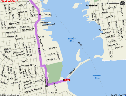
Directions
Latitude: 40° 37.428′ N, Longitude: 70° 54.771′ W
|
By Land
|
By Sea
|
|
| I-195 E / W toward New Bedford Merge onto MA-18 S via EXIT 15 toward DOWNTOWN / New Bedford (0.9 miles) MA-18 S becomes JOHN F KENNEDY MEMORIAL HWY (1.3 miles) Turn LEFT onto POTOMSKA STREET (>0.1 miles) Turn immediate RIGHT onto S FRONT STREET (0.3 miles) Turn LEFT onto GIFFORD STREET (0.3 miles) End at 109 Gifford St |
Heading due North New Bedford harbor entrance channel
Pass-thru hurricane barrier & keep Palmer Island on port side Proceed Northerly to 1st green can buoy Turn 90° to port (due West) to next green can buoy by bulkhead Turn 90° to port (due South) into Palmer Cove Mooring field & dock in southwest corner of cove |
